Keywords:Big Bend, Historic Place, Mariscal Mine, Mine, National Park, Texas
Photo Info
Dimensions7261 x 2785
Original file size11.4 MB
Image typeJPEG
Color spacesRGB
Date taken10-Mar-15 15:08
Date modified24-Jan-16 13:30
Shooting Conditions
Camera makeNIKON CORPORATION
Camera modelNIKON D800
Focal length28 mm
Focal length (35mm)28 mm
Max lens aperturef/3.5
Exposure1/500 at f/11
FlashNot fired, compulsory mode
Exposure bias0 EV
Exposure modeAuto
Exposure prog.Normal
ISO speedISO 200
Metering modePattern
Digital zoom1x
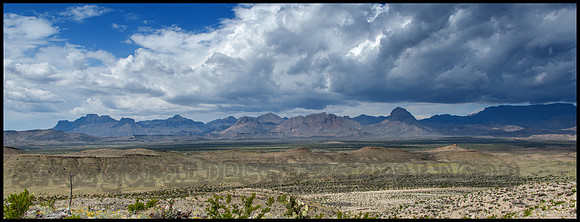
Southern View of Chisos Mountins - Big Bend NP-Texas
The Chisos Mountains. The range of mountains extends twenty miles from Punta de la Sierra in the southwest to Panther Junction in the northeast. An extensive trail system and permit-required backcountry campsites are maintained by Big Bend National Park for its visitors. The Northeast Rim and Southeast Rim trails are closed from February 1 through May 31 along with some of the backcountry campsites along these trails to protect the local Peregrine Falcon population.
The mountain area is partly forested (recovering from logging and overgrazing prior to the area's inclusion in the National Park System in the 1930s), and surrounded by the Chihuahuan Desert.